
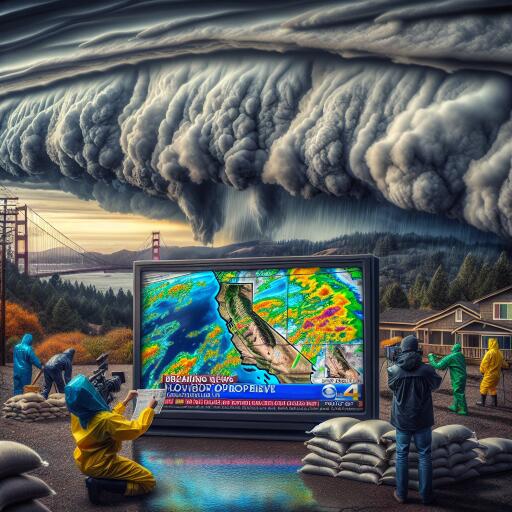

Flood Watches Issued as Wet Winter Storms Sweep Through California
California finds itself at the mercy of Mother Nature once again as a new series of wet winter storms makes landfall, starting in Northern California and planning a southward journey over the upcoming days. With the arrival of this storm, residents are being cautioned about potential flooding, hail, vigorous winds, and the rare occurrence of brief tornadoes.
Winds have already surged past 30 mph in regions such as Oakland and San Jose, following a mild cold front that set the stage for a stronger storm system. This system, which started to intensify late Saturday, is expected to peak in strength by early Monday. “The winds have begun to escalate, signaling that heavy rains are soon to follow,” explained a weather forecasting expert.
The central coast of California is particularly vulnerable, with forecasts predicting up to 5 inches of rain could inundate many areas. Some isolated locales, especially in the Santa Lucia and Santa Ynez mountain ranges, might see rain totals soaring to about 10 inches as the storm pushes towards the Los Angeles area. This significant amount of rainfall raises alarms for potential “significant flooding.”
Moreover, the coming days could see an unusual meteorological phenomenon in the valleys surrounding the state capital. “Monday could witness the formation of brief tornadoes, alongside a mixture of small but abundant hail, heavy rainfall, lightning, and blustery winds,” warned meteorologists from the Sacramento region.
This incoming storm, though moving swiftly than the atmospheric rivers that previously wreaked havoc across Southern California, still poses a considerable threat. The last such event transformed streets into rivers, triggered numerous landslides, and was blamed for several fatalities.
While this storm system mirrors some aspects of an atmospheric river, primarily due to a band of subtropical moisture trailing the storm, it is primarily styled as a cold front – albeit, a markedly potent one. The strength of this cold front is enough to provoke flash flooding and power outages, thus stoking concerns among meteorologists. Consequently, flood watches and warnings have been plastered across both coastal and mountainous regions throughout the state.
Even mountainous areas won’t escape the rainfall, though higher elevations above roughly 6,800 feet in the Sierra Nevada are expected to be coated in several feet of snow. Travelers are advised to avoid mountain paths if possible.
In anticipation of the storm’s impact, the California Governor’s Office of Emergency Services has been activated. The office has already begun positioning personnel and emergency equipment in areas deemed to be at the highest risk of facing the storm’s wrath.
In conclusion, as California braces for this latest onslaught of wet winter weather, officials are taking every precaution to mitigate the impact of the storm. Residents in vulnerable areas are urged to stay informed and prepared for the wide array of severe weather conditions forecasted in the coming days.