

Severe Wind Storms Disrupt Major Ferry Services in South Coast B.C., Prompting Safety Concerns
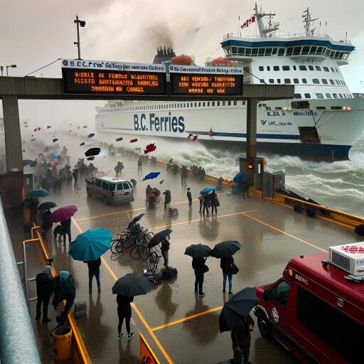
Unprecedented wind speeds reaching up to 100 km/h have led to widespread disruptions in ferry services off the south coast of British Columbia this past Saturday, highlighting the ferocity of the latest atmospheric conditions to hit the region. The intense weather activity, driven by two consecutive storms, has prompted a high alert for potential flooding and significant wind damage across various communities.
Anticipating the severe weather impact, B.C. Ferries, a critical transportation link between the Lower Mainland and Vancouver Island, among other routes, took proactive measures by cancelling a slew of sailings. The decision, primarily focusing on safety, affected key routes including those connecting the Greater Victoria area with the Lower Mainland and several sailings between the Sunshine Coast, and the nearby Gambier and Keats islands.
Early Saturday, cancellations affected the most frequented ferry passages, including disruptions to the schedule connecting Tsawwassen and Swartz Bay. Specific cancellations included the prominent noon sailing from Tsawwassen, and an early afternoon sailing from Swartz Bay, besides several other routes intended for the morning and early afternoon operations.
In a detailed advisory, Environment and Climate Change Canada (ECCC) forecasted an extraordinary wind event over the weekend, stressing the likelihood of winds accelerating to 100 km/h in regions encompassing the Greater Victoria and Southern Gulf Islands. This brisk weather phenomenon was not isolated, as parts of Metro Vancouver were also advised of winds peaking up to 90 km/h, with a probable onset of minor coastal flooding escalating concerns for residents and travelers alike.
The advisory went on to highlight the risk posed by violent winds, which were capable of turning unsecured objects into potential hazards, thereby raising the ante for injuries or broader damages. The statement emphasized that locales bordering the Strait of Georgia were at an elevated risk for minor coastal flooding, especially during Sunday morning’s high tide which added another layer of urgency to the weekend’s weather woes.
While the bulk of the storm was anticipated to subside by Sunday morning, the weather outlook remained grim for other parts of the region. Specifically, a cautionary tale was spelled out for those in the Whistler and Sea to Sky corridor areas with warnings of “heavy wet snow” that could disrupt the tranquillity of the picturesque locales. Brought about by the same frontal system, the snowfall expected in the Sea to Sky corridor was predicted to accumulate rapidly under intense periods of precipitation, potentially leading to treacherous road conditions.
In light of these developments, authorities are urging residents and travelers alike to stay vigilantly updated with the latest weather forecasts, prepare for a range of adverse condition, and align travel plans with the dynamic nature of the current weather phenomena sweeping across the South Coast of British Columbia.